Highlights
An awesome airport/aviation weather conditions map with real-time updates!
About This Deal
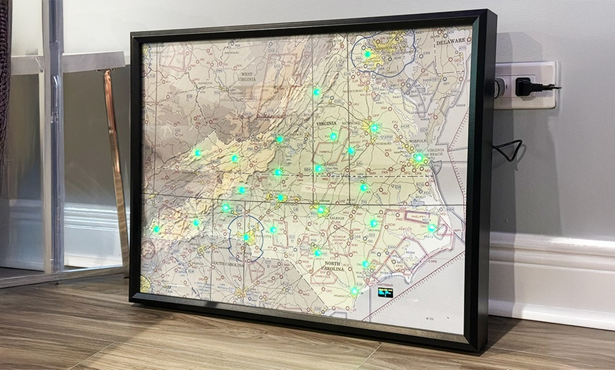
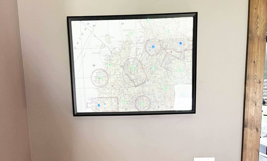
Custom LED METAR Map – Live Aviation Weather Display for Pilots & Enthusiasts
Bring real-time airport conditions into your home, hangar, or office with this fully customizable LED METAR map. Each map is handcrafted to display live weather data using color-coded LEDs – a perfect gift for pilots, flight schools, or aviation lovers. On power-up it plays a short legend once, then auto-updates live METARs.
Want something totally unique? Message with your idea for custom layouts, adding logos, or creating route-specific maps (like a cross-country trip).
What We Offer
- Custom METAR Map (Base)
- Custom METAR Map with Overlays
- Custom METAR Map with OLED Screen
Additional airports can be added for a fee, allowing you to build a personalised map tailored to your flying routes or favourite regions.
What’s Included
- Hand-built LED map with 10 included airports
- Live METAR-based color updates for each LED (VFR green, MVFR blue, IFR red, LIFR magenta)
- One-time boot legend demo, then live operation
- Mounted on durable backing
- USB-powered (cord included)
Upgrade Options
-
OLED Screen: Adds a live 128×64 display that shows the full METAR report for one selected airport (or rotates through your list).
-
LED Overlays: Weather-triggered effects:
- Lightning alert
- Above your custom gust threshold
- High-wind warning
- Rain
- Snow
- Fog wash overlays
Add Extra Airports
Your base map includes 10 airports. Need more? +$10 per additional LED/airport.
Airport Selection
Enter your preferred airports or a general region (e.g., "Florida coast", "Chicago–Denver route"). I’ll send layout samples to choose from before building.
If a chosen airport doesn’t report METARs, I’ll use the nearest reporting station to match your request as closely as possible.
Great For
- Pilots (student, private, commercial)
- CFIs and flight schools
- Aviation-themed gifts
- Weather geeks & avgeeks
FAQ
Q: What’s included at the base price?
A: A custom LED map with up to 10 selected airports, using live METAR data to color-code each LED based on current conditions.
Q: What are the upgrade options?
A: Here are the options:
- OLED Screen: Shows the full METAR on a 128×64 display (single airport or rotating).
- LED Custom: Enables lightning blink alerts, wind fade/blink with your threshold, high-wind warning color, day/night brightness, and optional rain/snow/fog overlays.
- Both Upgrades: Includes all of the above.
Q: How do I add more than 10 airports?
A: Use the "Extra Airports" variation at checkout. Each extra airport (LED) is +$10. You can add up to 10 additional for a total of 20.
Q: What if my chosen airport doesn’t report METAR?
A: I’ll find the nearest METAR-reporting station and adjust the LED placement and labeling accordingly.
Q: Can I choose a region or route instead of specific airports?
A: Yes! Describe the region (e.g., "New England", "Southern California", "route from Dallas to Atlanta") in the personalization box. I’ll mock up layout samples for approval.
Q: How is the map powered?
A: The map is powered via USB (5V). You can plug it into any USB port; a wall adapter is included.
Will be picked up from address.
Fine Print
About Metar Maps
Just a small, garage business sharing the passion of aviation :)